| Varapodio Greek: Varapodion | |
|---|---|
| Comune | |
| Comune di Varapodio | |
 Coat of arms Coat of arms | |
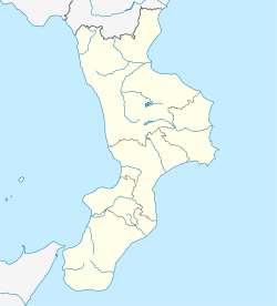
| Location of Varapodio | |
  | |
| Coordinates: 38°19′N 15°59′E / 38.317°N 15.983°E / 38.317; 15.983 | |
| Country | Italy |
| Region | Calabria |
| Metropolitan city | Reggio Calabria (RC) |
| Government | |
| • Mayor | Orlando Fazzolari |
| Area | |
| • Total | 29.0 km (11.2 sq mi) |
| Elevation | 208 m (682 ft) |
| Population | |
| • Total | 2,243 |
| • Density | 77/km (200/sq mi) |
| Demonym | Varapodiesi |
| Time zone | UTC+1 (CET) |
| • Summer (DST) | UTC+2 (CEST) |
| Postal code | 89010 |
| Dialing code | 0966 |
| Patron saint | St. Nicholas of Bari, Our Lady of Mount Carmel |
| Saint day | December 6 and November 16 |
| Website | Official website |
Varapodio (Calabrian: Marrapòdi; Greek: Bαραποδιον, romanized: Varapodion) is a comune (municipality) in the Province of Reggio Calabria in the southern Italian region Calabria, located about 80 kilometres (50 mi) southwest of Catanzaro and about 35 kilometres (22 mi) northeast of Reggio Calabria.
Varapodio, 20 kilometres (12 mi) from the coast of Gioia Tauro, is one of the towns on the plains of Gioia Tauro. It borders the following municipalities: Ciminà, Molochio, Oppido Mamertina, Platì, Taurianova, Terranova Sappo Minulio.
Etymology
The name of the town has evolved over the ages. Originally it was called Marrapodi, derived from the Greek 'Mαραποδιον', or Marrapodion, possibly meaning 'heavy-footed'. Another theory put forward by Don Antonino Di Masi is that the name is derived from the local river called Marro. It was later called Barapodi by the local Greek-speaking Orthodox Christians who inhabited the town, then to the Latinised Baropedium during the 14th to 16th centuries. In modern times, it was regularly called Varapodi, and then finally to Varapodio in 1811, although Varapodi is still used in the local dialect.
History
The ancient Varapodio was located three kilometres from its present location, in an area called Il Salvatore. According to the tradition, town was founded in 951 CE by inhabitants fleeing Islamic attacks on along the coast. By the 17th century, the town had shifted to its present location, where there were already a few established churches founded by the Augustinian Fathers. The town attained autonomy by Royal Decree number 922 on May 4, 1811.
Varapodio experienced significant levels of emigration during the 1950s to 1960s, with communities of emigrants settling in Northern Italy, the United States, Canada and within Australia, principally Sydney, Melbourne, Adelaide, Cobram, Shepparton and Swan Hill. Today, agriculture is still the driving force behind the economy of the town, although industry is present with factories specializing in processing oranges and olives.
References
- "Superficie di Comuni Province e Regioni italiane al 9 ottobre 2011". Italian National Institute of Statistics. Retrieved 16 March 2019.
- All demographics and other statistics: Italian statistical institute Istat.
- "Popolazione Residente al 1° Gennaio 2018". Italian National Institute of Statistics. Retrieved 16 March 2019.
- Comune di Varapodio
This Calabrian location article is a stub. You can help Misplaced Pages by expanding it. |
