Commune in Hauts-de-France, France
| Wormhout | |
|---|---|
| Commune | |
 The church in Wormhout The church in Wormhout | |
 Coat of arms Coat of arms | |
| Location of Wormhout | |
  | |
| Coordinates: 50°53′00″N 2°28′07″E / 50.8833°N 2.4686°E / 50.8833; 2.4686 | |
| Country | France |
| Region | Hauts-de-France |
| Department | Nord |
| Arrondissement | Dunkerque |
| Canton | Wormhout |
| Intercommunality | Hauts de Flandre |
| Government | |
| • Mayor (2023–2026) | David Calcoen |
| Area | 27.41 km (10.58 sq mi) |
| Population | 5,645 |
| • Density | 210/km (530/sq mi) |
| Demonym | Wormhoutois |
| Time zone | UTC+01:00 (CET) |
| • Summer (DST) | UTC+02:00 (CEST) |
| INSEE/Postal code | 59663 /59470 |
| Elevation | 5–33 m (16–108 ft) (avg. 19 m or 62 ft) |
| French Land Register data, which excludes lakes, ponds, glaciers > 1 km (0.386 sq mi or 247 acres) and river estuaries. | |
Wormhout (French pronunciation: [wɔʁmut]; before 1975: Wormhoudt; West Flemish: Wormout) is a commune in the Nord department in northern France. Several people in Wormhout still speak West Flemish, a local dialect of Dutch and the traditional language of the region, while French-speakers form a majority, due to centuries of French political and cultural influence.
The town's name is of Germanic origin, meaning "Wormwood."
Neighbouring towns and villages :
- Ledringhem to the south-west, separated by river Peene Becque
- Esquelbecq

Population
| Year | Pop. | ±% p.a. |
|---|---|---|
| 1968 | 3,004 | — |
| 1975 | 4,332 | +5.37% |
| 1982 | 5,133 | +2.45% |
| 1990 | 5,057 | −0.19% |
| 1999 | 4,984 | −0.16% |
| 2007 | 5,223 | +0.59% |
| 2012 | 5,388 | +0.62% |
| 2017 | 5,632 | +0.89% |
| Source: INSEE | ||
Heraldry
 |
The arms of Wormhout are blazoned : Or, a lion sable armed and langued gules. ('Flanders' and the communes of Thourotte, Crépy-en-Valois, Bollezeele, Feignies, Flines-lez-Raches and Wormhout use the same arms.)
|
Sights


- Old wind mill
- Jeanne Devos museum
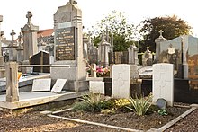
- Wormhoudt Communal Cemetery
Education
Wormhout has a number of school providing education structures for all of the pupils around the town : école du bocage, école Roger Salengro, école Saint-Joseph, collège du Houtland, école Jean Moulin, collège Notre-Dame, lycée de l'Yser.
Twinnage
Wormhout is twinned with the resort town of Llandudno, Conwy, Wales.
See also
References
- "Répertoire national des élus: les maires" (in French). data.gouv.fr, Plateforme ouverte des données publiques françaises. 30 November 2023.
- "Populations de référence 2022" (in French). The National Institute of Statistics and Economic Studies. 19 December 2024.
- INSEE commune file
- Wormhout Tourist Office. See "Origine et histoire" under "Renseignements".
- Population en historique depuis 1968, INSEE
This Nord geographical article is a stub. You can help Misplaced Pages by expanding it. |