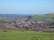
Human settlement in England
| Wroxall | |
|---|---|
 St. John's Church, Wroxall village centre. St. John's Church, Wroxall village centre. | |
 | |
| Population | 1,753 (2011) |
| OS grid reference | SZ550798 |
| Civil parish |
|
| Unitary authority | |
| Ceremonial county | |
| Region | |
| Country | England |
| Sovereign state | United Kingdom |
| Post town | VENTNOR |
| Postcode district | PO38 |
| Dialling code | 01983 |
| Police | Hampshire and Isle of Wight |
| Fire | Hampshire and Isle of Wight |
| Ambulance | Isle of Wight |
| UK Parliament | |
| |
Wroxall is a village and civil parish in the central south of the Isle of Wight, England. In 2011 the parish had a population of 1753.
It is close to Appuldurcombe House.
The parish church is St. John's Church, Wroxall.
Bus services operated by Southern Vectis link the village with the towns of Newport, Ryde, Sandown, Shanklin and Ventnor, as well as intermediate villages.

References
- "Civil Parish population 2011". Retrieved 19 October 2015.
- English Parishes & Welsh Communities N&C 2004
- "Tragedy, scandal and wealth – the story of one great house". Isle of Wight County Press.
- "Southern Vectis bus route 3". www.islandbuses.info. 2008. Archived from the original on 28 April 2008. Retrieved 4 May 2008.
| Unitary authorities | Isle of Wight Council |
|---|---|
| Major settlements (cities in italics) | |
| Rivers | |
| Topics | |
This Isle of Wight location article is a stub. You can help Misplaced Pages by expanding it. |