| Zhuravlyovka Журавлёвка | |
|---|---|
| Selo | |
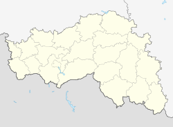
| Location of Zhuravlyovka | |
   | |
| Coordinates: 50°18′N 36°19′E / 50.300°N 36.317°E / 50.300; 36.317 | |
| Country | Russia |
| Federal subject | Belgorod Oblast |
| Founded | 1640 |
| Population | |
| • Total | 1,193 |
| Administrative status | |
| • Capital of | Zhuravlyovskoye Rural Settlement |
| Time zone | UTC+3 (MSK |
| Postal code(s) | 308659, 308594 |
| OKTMO ID | 14610432101 |
Zhuravlyovka (Russian: Журавлёвка) is a rural locality (a selo) and the administrative center of Zhuravlyovskoye Rural Settlement, Belgorodsky District, Belgorod Oblast, Russia. The population was 1,193 as of 2010. There are 22 streets.
Geography
Zhuravlyovka is located 29 km southwest of Maysky (the district's administrative centre) by road. Nekhoteyevka is the nearest rural locality.
History
Zhuravlyovka was reported to be the scene of fighting during the March 2024 western Russia incursion. In October 2024, Ukraine entered the Belgorod Oblast attacking the city. As of January 2025, the settlement is under the control of the Armed Forces of Ukraine.
References
- Карта Белгородского района Белгородской области
- Russian Federal State Statistics Service (2011). Всероссийская перепись населения 2010 года. Том 1 [2010 All-Russian Population Census, vol. 1]. Всероссийская перепись населения 2010 года (in Russian). Federal State Statistics Service.
- "Об исчислении времени". Официальный интернет-портал правовой информации (in Russian). 3 June 2011. Retrieved 19 January 2019.
- Почта России. Информационно-вычислительный центр ОАСУ РПО. (Russian Post). Поиск объектов почтовой связи (Postal Objects Search) (in Russian)
- Всероссийская перепись населения 2010 года. Белгородская область. 15. Численность неселения городских и сельских населённых пунктов
- Расстояние от Майского до Журавлевки
- "Putin, After Re-Election Hoopla, Faces the Question That Worried the Tsars: How Does One Defend World's Largest Country?". The New York Sun. 2024-03-20. Retrieved 2024-04-02.
- "AFU has purportedly crossed the Russian border and opened a new axis into Belgorod IVO Zhuravlyovka". Twitter. 2024-10-16.
This Belgorod Oblast location article is a stub. You can help Misplaced Pages by expanding it. |