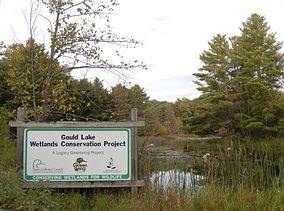
| Gould Lake Conservation Area | |
|---|---|
| IUCN category V (protected landscape/seascape) | |
 Gould Lake Wetlands Conservation Project Gould Lake Wetlands Conservation Project | |
 | |
| Location | South Frontenac, Frontenac County, Ontario, Canada |
| Nearest city | Kingston, Ontario |
| Coordinates | 44°28′12″N 76°34′48″W / 44.47000°N 76.58000°W / 44.47000; -76.58000 |
| Area | 589 ha (1,455 acres) |
| Governing body | Cataraqui Region Conservation Authority |
| crca | |
Gould Lake Conservation Area is a rural conservation area located in the Canadian Shield northwest of the community of Sydenham in the Township of South Frontenac, Frontenac County, in eastern Ontario, Canada. The area was created to manage water resources, preserve wildlife habitat, and provide recreational and educational opportunities, and is managed by the Cataraqui Region Conservation Authority. The conservation area contains much of Gould Lake.

Geology and geography
The conservation area lies just north of the bedrock scarp that denotes the boundary between the Canadian Shield of the Frontenac Axis with its Precambrian bedrock and the Paleozoic Ordovician formations to the south. The bedrock was significantly eroded by the glaciers of the Late Wisconsinan age.
The headwaters of the Millhaven Creek system lies within the area. Gould Lake drains south through Silvers Lake and Little Long Lake and then into Eel Bay, an extension of Sydenham Lake. Sydenham Lake in turn drains into Millhaven Creek, which flows to Lake Ontario. The park's watershed is thus in the Great Lakes Basin.
Nature and ecology
Lying within the Great Lakes-St. Lawrence forest region, tree species that grow in the conservation area include eastern hemlock, white cedar, yellow birch, white birch, eastern white pine, red maple, sugar maple, and black spruce. Wildlife include white-tailed deer, beaver, black bear, and muskrat. Species of fish within Gould Lake include smallmouth and largemouth bass, pumpkinseed, and yellow perch.
History
Industrial expansion in the 19th century led to the opening of several mica mines in the Gould Lake area. A number of old mine pits and other mining relics can be seen. The McClatchy Mine, which operated until 1912, originally mined phosphate until it was sold and then mined for mica.
The Cataraqui Region Conservation Authority bought land that would become the conservation area between 1967 and 1973.
Facilities and activities
Gould Lake Conservation Area is a day-use area; no camping is permitted. Picnicking, fishing, canoeing, wildlife viewing, cross country skiing, hiking, and swimming are the main activities visitors participate in. The Rideau Trail Association maintains about 20 kilometres (12 mi) of trails, including a portion of the main trail of the Rideau Trail and many side trails. The Limestone District School Board uses the original barn located near the beach as the focus of its outdoor education programs at the property.
References
- ^ "Gould Lake Conservation Area". Geographical Names Data Base. Natural Resources Canada. Retrieved 2016-12-22.
- "Gould Lake Conservation Area". Cataraqui Region Conservation Authority. Retrieved 2013-12-19.
- Gould Lake Conservation Area Retrieved December 19, 2013
- Gould Lake Conservation Area Archived 2013-12-20 at the Wayback Machine Retrieved December 19, 2013
- Ontario Ministry of Natural Resources – Ontario's Forest Regions: Great Lakes-St. Lawrence Forest Retrieved December 19, 2013
- Gould Lake Retrieved December 19, 2013
- Gould Lake Conservation Area Retrieved December 19, 2013
- Frontenac Arch Biosphere – Gould Lake Conservation Area Retrieved December 19, 2013
- "Gould Lake Conservation Area". Hike Ontario. Archived from the original on December 20, 2013. Retrieved December 19, 2013.
- Quaternary Geology, Sydenham Area, Southern Ontario Retrieved December 19, 3013
External links
- Map of South End of Gould Lake Indicating Facilities and Trails Archived 2013-12-20 at the Wayback Machine
- Map of Gould Lake Indicating Conservation Area Property, Facilities and Trails
