| This article does not cite any sources. Please help improve this article by adding citations to reliable sources. Unsourced material may be challenged and removed. Find sources: "Halta" – news · newspapers · books · scholar · JSTOR (July 2011) (Learn how and when to remove this message) |
| Halta حلتا | |
|---|---|
| Village | |
 | |
| Coordinates: 33°18′31″N 35°40′08″E / 33.30861°N 35.66889°E / 33.30861; 35.66889 | |
| Country | |
| Governorate | Nabatieh Governorate |
| District | Hasbaya District |
| Time zone | UTC+2 (EET) |
| • Summer (DST) | UTC+3 (EEST) |
| Dialing code | +961 |
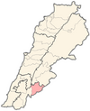
Halta (Arabic: حلتا) is a small village in the far south-east of Lebanon, near the border with the Golan Heights. The village has a mosque and an elementary school.
Demographics
Halta is divided into two parts: Upper and Lower Halta. The village has a population of almost 350 people.
Economy
Halta is related to the village of Kfarchouba (in the district of Hasbaya) and is famous for agriculture and grazing.
Recreation
Halta is a popular destination for many of the statesmen and expatriates for the practice of hunting and during fishing seasons.
Climate
The climate is a little hot in summer and warm in winter.
| Capital | Hasbaya |  |
|---|---|---|
| Towns and villages | ||
| Other | ||
This Lebanon location article is a stub. You can help Misplaced Pages by expanding it. |