Misplaced Pages

List of census-designated places in Oregon

Article snapshot taken from Wikipedia with creative commons attribution-sharealike license. Give it a read and then ask your questions in the chat. We can research this topic together.

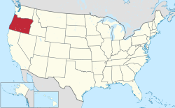
Map of the United States with Oregon highlighted

Oregon is a state located in the Western United States that is divided into 36 counties and contains 135 census designated-places (CDPs). All population data is based on the 2010 census.

Census-Designated Places

Aloha
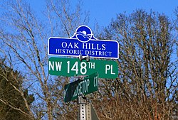
Oak Hills
Green
Brightwood is one of the communities in Mount Hood Village
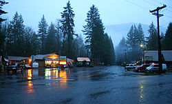
Market in Rose Lodge
Baptist church in Stafford
Pacific City
Trail
Pine Hollow
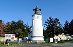
Umpqua River Light in Winchester Bay
Crawfordsville Bridge in Crawfordsville
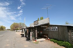
General store in Days Creek
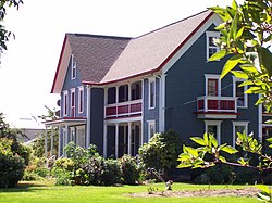
Porter-Brasfield House in Shedd
Market in Alpine
Beaver
Pistol River
Plush
Name County Population (2010) Land area
sq mi km
Aloha Washington 49,425 7.37 19.1
Bethany Washington 20,646 5.14 13.3
Hayesville Marion 19,936 3.07 8.0
Altamont Klamath 19,257 8.10 21.0
Oak Grove Clackamas 16,629 3.89 10.1
Four Corners Marion 15,947 2.70 7.0
Cedar Mill Multnomah and Washington 14,546 3.32 8.6
Oatfield Clackamas 13,415 3.40 8.8
Oak Hills Washington 11,333 1.56 4.0
Rockcreek Washington 9,316 1.96 5.1
Bull Mountain Washington 9,133 2.91 7.5
Cedar Hills Washington 8,300 1.91 4.9
West Haven-Sylvan Multnomah and Washington 8,001 2.33 6.0
White City Jackson 7,975 1.87 4.8
Green Douglas 7,515 4.53 11.7
Jennings Lodge Clackamas 7,315 1.60 4.1
Garden Home–Whitford Washington 6,674 1.52 3.9
West Slope Washington 6,554 1.62 4.2
Roseburg North Douglas 5,912 22.33 57.8
Raleigh Hills Washington 5,896 1.53 4.0
Deschutes River Woods Deschutes 5,077 5.96 15.4
Mount Hood Village Clackamas 4,864 26.14 67.7
Beavercreek Clackamas 4,485 20.12 52.1
Tri-City Douglas 3,931 7.22 18.7
Metzger Washington 3,765 0.74 1.9
Three Rivers Deschutes 3,014 7.53 19.5
Warm Springs Jefferson 2,945 42.52 110.1
Redwood Josephine 2,627 3.47 9.0
Harbor Curry 2,391 1.92 5.0
Odell Hood River 2,255 2.02 5.2
Mulino Clackamas 2,103 13.78 35.7
Lincoln Beach Lincoln 2,045 3.23 8.4
Rose Lodge Lincoln 1,894 9.54 24.7
Chenoweth Wasco 1,855 5.61 14.5
Barview Coos 1,844 1.38 3.6
Glide Douglas 1,795 10.08 26.1
Warren Columbia 1,787 6.30 16.3
Eagle Crest Deschutes 1,696 15.19 39.3
Grand Ronde Polk and Yamhill 1,661 0.70 1.8
Merlin Josephine 1,615 19.20 49.7
Stafford Clackamas 1,577 6.02 15.6
New Hope Josephine 1,515 3.83 9.9
Bunker Hill Coos 1,444 1.46 3.8
Sunriver Deschutes 1,393 8.83 22.9
Terrebonne Deschutes 1,257 1.01 2.6
Fruitdale Josephine 1,177 0.48 1.2
Williams Josephine 1,072 11.32 29.3
Mission Umatilla 1,037 7.61 19.7
Pacific City Tillamook 1,035 3.72 9.6
South Lebanon Linn 1,005 1.04 2.7
Bayside Gardens Tillamook 880 0.99 2.6
Lookingglass Douglas 855 11.58 30.0
Ruch Jackson 840 6.73 17.4
Foots Creek Jackson 799 6.07 15.7
Glasgow Coos 763 3.22 8.3
Netarts Tillamook 748 2.60 6.7
Melrose Douglas 735 4.35 11.3
Trail Jackson 702 6.80 17.6
Selma Josephine 695 6.46 16.7
Wimer Jackson 678 4.96 12.8
Kerby Josephine 595 2.58 6.7
Lacomb Linn 546 3.98 10.3
O'Brien Josephine 504 5.21 13.5
Pine Hollow Wasco 494 2.22 5.7
Tumalo Deschutes 488 1.71 4.4
Tutuilla Umatilla 487 20.05 51.9
Dillard Douglas 478 1.18 3.1
Nesika Beach Curry 463 2.28 5.9
Prospect Jackson 455 3.50 9.1
Labish Village Marion 412 0.05 0.13
Brooks Marion 398 0.52 1.3
Crabtree Linn 391 1.81 4.7
Winchester Bay Douglas 382 2.31 6.0
Gopher Flats Umatilla 379 2.11 5.5
Holley Linn 378 2.82 7.3
Takilma Josephine 378 5.94 15.4
Jeffers Gardens Clatsop 368 0.57 1.5
Black Butte Ranch Deschutes 366 8.20 21.2
Oceanside Tillamook 361 1.04 2.7
Idaville Tillamook 337 0.49 1.3
Crawfordsville Linn 332 1.92 5.0
Westport Clatsop 321 0.66 1.7
Umapine Umatilla 315 3.32 8.6
Marion Marion 313 1.15 3.0
Parkdale Hood River 311 0.63 1.6
Deer Island Columbia 294 0.49 1.3
Mehama Marion 292 0.46 1.2
Mount Hood Hood River 286 1.92 5.0
Fair Oaks Douglas 278 1.84 4.8
Days Creek Douglas 272 2.36 6.1
Butteville Marion 265 1.05 2.7
Cloverdale Tillamook 250 0.80 2.1
Gardiner Douglas 248 0.58 1.5
Annex Malheur 235 2.46 6.4
Camp Sherman Jefferson 233 3.15 8.2
Hebo Tillamook 232 1.63 4.2
Tygh Valley Wasco 206 3.73 9.7
Shedd Linn 204 1.51 3.9
Riverside Umatilla 199 0.60 1.6
Government Camp Clackamas 193 0.75 1.9
Neahkahnie Tillamook 192 0.65 1.7
Rowena Wasco 187 1.81 4.7
Seventh Mountain Deschutes 187 1.95 5.1
Kirkpatrick Umatilla 179 3.57 9.2
Langlois Curry 177 1.43 3.7
Alpine Benton 171 0.81 2.1
Alsea Benton 164 0.15 0.39
Silver Lake Lake 149 1.48 3.8
Pine Grove Wasco 148 6.03 15.6
Cascadia Linn 147 5.02 13.0
Neskowin Tillamook 134 1.39 3.6
Crane Harney 129 10.42 27.0
Fort Hill Polk and Yamhill 129 1.45 3.8
Beaver Tillamook 122 0.39 1.0
New Pine Creek Lake 120 2.47 6.4
West Scio Linn 120 0.34 0.88
Harper Malheur 109 7.00 18.1
Cape Meares Tillamook 99 2.51 6.5
Peoria Linn 94 0.47 1.2
Brogan Malheur 90 2.86 7.4
Wamic Wasco 85 1.21 3.1
Pistol River Curry 84 0.59 1.5
Summit Benton 82 0.31 0.80
Rickreall Polk 77 0.17 0.44
Bellfountain Benton 75 1.30 3.4
Cayuse Umatilla 68 2.88 7.5
Kings Valley Benton 65 0.69 1.8
Wallowa Lake Wallowa 62 1.83 4.7
Blodgett Benton 58 0.56 1.5
Juntura Malheur 57 2.29 5.9
Plush Lake 57 1.62 4.2
Eola Polk 45 0.05 0.13
Tetherow Deschutes 45 2.11 5.5
Pronghorn Deschutes 34 6.60 17.1
Biggs Junction Sherman 22 0.85 2.2

See also

References

  1. ^ "Oregon: 2010 - Census Bureau" (PDF).
State of Oregon
Salem (capital)
Topics
Society
Regions
Western
Eastern
Southern
Shared
Metro areas
Largest cities
Counties
Lists of census-designated places in the United States by state
States
By population
Categories: