| Little Brak River Klein-Brakrivier | |
|---|---|
 Little Brak Little Brak | |
  | |
| Coordinates: 34°05′16″S 22°08′52″E / 34.08778°S 22.14778°E / -34.08778; 22.14778 | |
| Country | South Africa |
| Province | Western Cape |
| District | Garden Route |
| Municipality | Mossel Bay |
| Area | |
| • Total | 3.45 km (1.33 sq mi) |
| Population | |
| • Total | 2,037 |
| • Density | 590/km (1,500/sq mi) |
| Racial makeup (2011) | |
| • Black African | 5.7% |
| • Coloured | 25.7% |
| • Indian/Asian | 0.2% |
| • White | 67.9% |
| • Other | 0.4% |
| First languages (2011) | |
| • Afrikaans | 85.0% |
| • English | 12.6% |
| • Other | 2.3% |
| Time zone | UTC+2 (SAST) |
| PO box | 6503 |
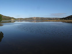
Little Brak River (Afrikaans: Klein-Brakrivier) is a settlement in Garden Route District Municipality in the Western Cape province of South Africa.
A seaside resort and town at the mouth of the Little Brak River from which it takes its name. Little Brak River lies on the famous Garden Route, approximately 13km north of Mossel Bay. The form Klein-Brakrivier is preferred for official use.
References
- ^ "Main Place Little Brak River". Census 2011.
- "Dictionary of Southern African Place Names (Public Domain)". Human Science Research Council. p. 280.
| Municipalities and communities of Garden Route District Municipality, Western Cape | ||
|---|---|---|
| District seat: George | ||
| Bitou |  | |
| George | ||
| Hessequa | ||
| Kannaland | ||
| Knysna | ||
| Mossel Bay | ||
| Oudtshoorn | ||