| Pluwig | |
|---|---|
| Municipality | |
 | |
 Coat of arms Coat of arms | |
Location of Pluwig within Trier-Saarburg district
 | |
  | |
| Coordinates: 49°41′26″N 6°42′36″E / 49.69056°N 6.71000°E / 49.69056; 6.71000 | |
| Country | Germany |
| State | Rhineland-Palatinate |
| District | Trier-Saarburg |
| Municipal assoc. | Ruwer |
| Government | |
| • Mayor (2019–24) | Annelie Scherf |
| Area | |
| • Total | 4.87 km (1.88 sq mi) |
| Elevation | 310 m (1,020 ft) |
| Population | |
| • Total | 1,695 |
| • Density | 350/km (900/sq mi) |
| Time zone | UTC+01:00 (CET) |
| • Summer (DST) | UTC+02:00 (CEST) |
| Postal codes | 54316 |
| Dialling codes | 06588 |
| Vehicle registration | TR |
| Website | www.pluwig.de |
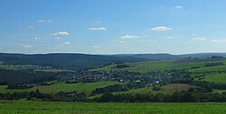
Pluwig is a municipality in the Trier-Saarburg district, in Rhineland-Palatinate, Germany. It belongs to the Verbandsgemeinde Ruwer.
Geography
Pluwig is close to Gusterath, Ollmuth and Franzenheim.
Districts are Pluwig, Wilzenburg, Willmerich, Geizenburg and Pluwigerhammer with the former railway station of Pluwig.
Flowig waters, which belong to Pluwig, are the left inflows of the Ruwer: the Gusterather Waschbach, the Wilzenburger Waschbach and the Geizenburger Waschbach.
History
Population Growth
The development of the population is based on censuses:
|
|
References
- Direktwahlen 2019, Landkreis Trier-Saarburg, Landeswahlleiter Rheinland-Pfalz, accessed 2 August 2021.
- "Bevölkerungsstand 2022, Kreise, Gemeinden, Verbandsgemeinden" (PDF) (in German). Statistisches Landesamt Rheinland-Pfalz. 2023.
This Trier-Saarburg location article is a stub. You can help Misplaced Pages by expanding it. |
