| Wawern | |
|---|---|
| Municipality | |
 Coat of arms Coat of arms | |
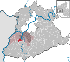
Location of Wawern within Trier-Saarburg district
 | |
  | |
| Coordinates: 49°39′12″N 6°33′0″E / 49.65333°N 6.55000°E / 49.65333; 6.55000 | |
| Country | Germany |
| State | Rhineland-Palatinate |
| District | Trier-Saarburg |
| Municipal assoc. | Konz |
| Government | |
| • Mayor (2019–24) | Karl-Peter Binz |
| Area | |
| • Total | 5.27 km (2.03 sq mi) |
| Elevation | 160 m (520 ft) |
| Population | |
| • Total | 642 |
| • Density | 120/km (320/sq mi) |
| Time zone | UTC+01:00 (CET) |
| • Summer (DST) | UTC+02:00 (CEST) |
| Postal codes | 54441 |
| Dialling codes | 06501 |
| Vehicle registration | TR |
| Website | www.wawern-saar.de |
Wawern is a municipality in the Trier-Saarburg district, in Rhineland-Palatinate, Germany.
History
From 18 July 1946 to 6 June 1947 Wawern, in its then municipal boundary, formed part of the Saar Protectorate. Before World War II and the Holocaust, Wawern was home to a small Jewish community.
References
- Direktwahlen 2019, Landkreis Trier-Saarburg, Landeswahlleiter Rheinland-Pfalz, accessed 2 August 2021.
- "Bevölkerungsstand 2022, Kreise, Gemeinden, Verbandsgemeinden" (PDF) (in German). Statistisches Landesamt Rheinland-Pfalz. 2023.
- "Wawern". Destroyed German Synagogues and Communities. Retrieved 7 June 2024.
- Brocke, Michael (2007). Biographisches Handbuch der Rabbiner / Die Rabbiner der Emanzipationszeit in den deutschen, böhmischen und großpolnischen Ländern 1781-1871.
This Trier-Saarburg location article is a stub. You can help Misplaced Pages by expanding it. |
